Last updated: June 2026 — road conditions and logistics verified June 2026.
Most travelers crossing Vietnam by motorbike take Highway 1 — the coastal road that runs through every beach town and city on the eastern seaboard. It’s paved, well-serviced, and makes navigation easy. It’s also the most boring road in Vietnam. The towns blur into each other, the trucks are constant, and the heat off the bitumen in July is genuinely unpleasant.
The Ho Chi Minh Road is a different proposition. It runs through the mountains that separate Vietnam from Laos, through the valleys where some of the most intense fighting of the American war happened, through national parks and jungle corridors that the coastal highway never touches. The road is paved. The surface is concrete slabs on the good sections, asphalt on the newer stretches. What it isn’t is crowded — on the best sections you can ride for an hour without passing another vehicle.
What the Ho Chi Minh Trail Actually Is
The original Hồ Chí Minh Trail (Đường Trường Sơn — “Truong Son Road”) was not a single road but a network of jungle paths, mountain tracks, and river crossings used by North Vietnam during the Vietnam War to move troops, weapons, and supplies south. At peak operation in the early 1970s, an estimated 20,000 people a month moved through the trail network. The US military dropped more than 3 million tons of bombs on the trail — more ordnance than was dropped in all of World War II combined.
The modern Ho Chi Minh Road, built between 2000 and 2008, follows parts of the original trail network but is a fully engineered road — concrete slab surfaces on the mountain sections, asphalt on the reconstructed stretches, bridge crossings where the old trail used fords. The historic significance is embedded in the landscape rather than displayed for tourists: the bomb craters in the forest south of Khe Sanh, the overgrown American firebase sites in the A Shau Valley near A Lưới, the military cemeteries with thousands of North Vietnamese soldiers who died on the trail.
⚠Real Talk
The “Ho Chi Minh Trail” in tourism marketing often conflates the historic wartime supply network with the modern paved road, which are not the same thing. The modern road is a comfortable, entirely paved highway. Sections of the original trail exist as hiking paths and dirt tracks accessible from the road — these require a guide and proper equipment, not just a motorbike. Be clear about which one you’re planning before you go.
The Best Sections — What’s Worth Riding
The Ho Chi Minh Road covers 1,880km. Not all of it is worth the detour from the coast. Here’s what matters:
Khe Sanh → Phong Nha — The Best 240km in Central Vietnam
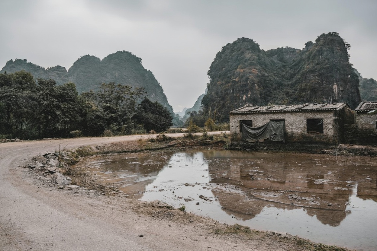
This is the section riders specifically come for. Starting at Khe Sanh town (site of one of the most intense sieges of the American war), the road heads northeast through the A Shau Valley corridor and into the Phong Nha-Kẻ Bàng National Park buffer zone. The last 100km thread between jungle-covered limestone karsts before descending to the Phong Nha valley.
The surface is largely single-lane concrete slabs — the road was built narrow because the terrain demands it. There’s almost no traffic: a few construction vehicles, the occasional local motorbike, one or two other traveling riders per day. The forest is dense on both sides. The sound of the engine bounces off the karst walls in the final section. Multiple riders describe this stretch as the best riding they’ve done anywhere.
Distance: 240km. Time: 2 days recommended — split at Long Sơn village (approximately 130km from Khe Sanh), which has basic guesthouses and gives you the final 110km to Phong Nha the next morning in daylight. Riding the full 240km in one day is possible but wastes the afternoon light on the best karst section.
↗Insider Tip
Leave Khe Sanh early — 7am — for the full day’s riding. The road climbs for the first 60km and the morning cool makes the gradient more manageable. Long Sơn village has basic accommodation for around 150,000–250,000 VND (~$6–10) per night — nothing comfortable, but sufficient. Book nothing; arrive and ask at the main street guesthouses. By 2025, a few travelers had written about Long Sơn on Vietnam travel forums, which means it occasionally fills on weekends during peak season (October). If it’s full, the next option is 40km further. Carry a backup plan.
A Lưới → Khe Sanh — The Historical Core
A Lưới (say: ah lwee) sits in the A Shau Valley — one of the most heavily bombed valleys in the history of aerial warfare. The A Shau was North Vietnam’s primary logistics corridor into South Vietnam’s central highlands, and the US military tried to close it for years. They failed. The valley floor and the surrounding mountains absorbed more ordnance than most countries have ever fired, and the landscape still carries it: overgrown craters, fragments of metal in the soil, UXO warning signs along the road’s edges.
Riding through A Lưới to Khe Sanh (about 130km, 3–4 hours) puts you in one of the most historically loaded landscapes in Vietnam. The road climbs out of the valley and over the mountain ridges with views that look peaceful now — jungle, cloud, distant mountains — but that were fire-support zones and bombing corridors within living memory of many Vietnamese still in these villages.
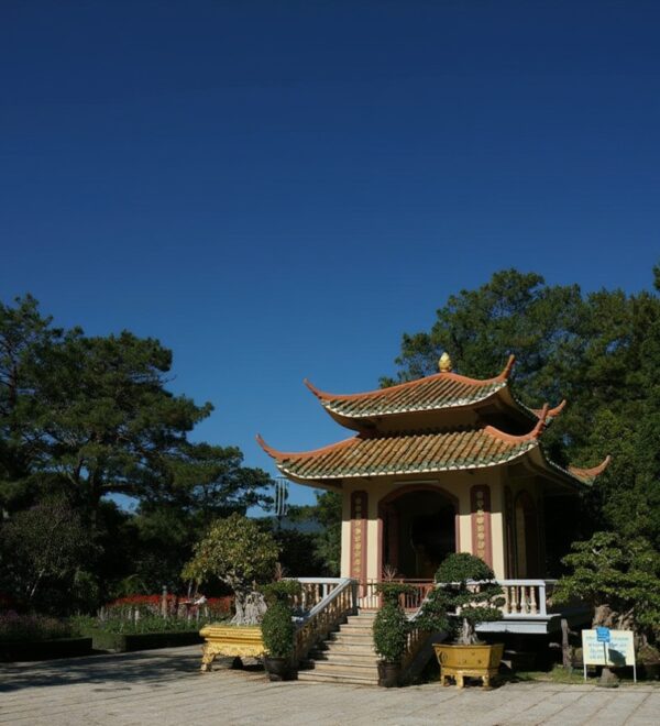
Khe Sanh Combat Base (Tà Cơn) is accessible from the road — a preserved battlefield site with aircraft wreckage, defensive bunkers, and a small museum explaining the 77-day siege in 1968 that put Khe Sanh on the front pages of American newspapers. Entry: 20,000 VND (~$0.80). Allow 1–2 hours. This is not a tourist spectacle — it’s a serious site that explains why the road you’re riding exists.
Phong Nha → A Lưới — The Mountain Middle
The central section between Phong Nha and A Lưới connects the limestone karst landscape of Quảng Bình province to the mountain highlands of the war’s most contested corridor. The road climbs progressively through increasingly remote terrain. Prao town (roughly the midpoint) has the last reliable fuel and food before the mountain section. Stock up.
The Central Highlands Section (Kon Tum → Buôn Ma Thuột → Đà Lạt)
South of the central section, the Ho Chi Minh Road continues through the Central Highlands — Kon Tum, Buôn Ma Thuột, Đà Lạt. This stretch has a different character from the northern sections: more agricultural, more traffic, more development. The mountain scenery is still excellent and the road surface is good, but the sense of remoteness that defines the Khe Sanh–Phong Nha section is absent. Most riders who prioritize the experience over completing the full route cut across to the coast at Đà Nẵng or Hội An after Phong Nha and skip the southern highland section.
Riding the Route — Practical Planning
The Ho Chi Minh Road can be ridden north to south (Hanoi → HCMC) or south to north. Most riders go north to south because it puts the best section (Khe Sanh → Phong Nha) at the end of the central segment when you’ve already found your riding rhythm. The elevation profile also works better N→S on the best sections — the long climbs are out of the valleys rather than into them.
The standard approach for travelers wanting to do the central highlights (not the full road) is to ride the coastal highway from Hanoi to Phong Nha, then switch to the western road from Phong Nha south to the Central Highlands, then cut back east to the coast at Đà Nẵng or Hội An. This 5–7 day central section captures the best of the western road without committing to the full 2-week north-south journey.
What Bike to Use
The Ho Chi Minh Road is fully paved — concrete slabs on the mountain sections, asphalt on reconstructed stretches. You do not need a dirt bike or an adventure bike. What you need is a bike that’s mechanically reliable, because the gaps between workshops on the remote sections are significant.
Semi-automatic (Honda Win, Detech, Wave): The standard backpacker choice in Vietnam. Adequate for the HCM Road — the concrete slab sections aren’t technical, just slow. The Win specifically has a reputation for breakdown frequency; make sure yours is in good condition before the mountain sections. Budget: 3,000,000–5,000,000 VND (~$114–190) to buy in Hanoi or Hội An.
Manual 150–200cc (Honda CRF, Yamaha WR): Better suited for the mountain passes and the occasional unpaved detour. More expensive to buy (6,000,000–12,000,000 VND, ~$228–455) but significantly more capable if you want to explore side roads off the main route. Rental available from specialist shops in Hanoi and Đà Nẵng.
What not to ride: 50cc scooters and city-spec automatics are underpowered for the mountain gradients and won’t handle the concrete slab surface well at speed. If you’re going to do the central section properly, a 100cc minimum is the practical floor.
For everything about buying, renting, licensing, and Vietnam motorbike mechanics, the Vietnam motorbike guide is the full reference.
Fuel, Food, and Accommodation on the Remote Sections
This is the most important practical section for anyone planning the western route. The Ho Chi Minh Road is not the coastal highway — the service infrastructure is sparse.
Fuel: Fill up at every opportunity once you leave the main towns. On the Khe Sanh → Phong Nha section, the roadside fuel sellers (jerricans and hand pumps) are infrequent and their stock is unreliable. Carry an extra 1–2 litres in a small container as insurance. A motorbike running out of petrol on a single-lane jungle road with no phone signal is a bad situation that’s completely avoidable.
commodation: Phong Nha has excellent guesthouse options at all price points. Khe Sanh town has basic to mid-range hotels. A Lưới has budget guesthouses. Long Sơn: very basic, confirm availability. Between these points, rural homestays exist but require Vietnamese communication to find and book. Plan your overnight stops at the named towns unless you’re comfortable with rural improvisation.
Best Time to Ride
The Ho Chi Minh Road’s central section has complicated weather because it spans the north-south weather divide that runs roughly through Đà Nẵng. The northern sections (Phong Nha, Khe Sanh) follow Hà Nội’s weather pattern — dry October to April, rainy May to September. The southern sections (A Lưới, Central Highlands) follow central Vietnam — dry March to August, rainy September to November.
Best window for the full central section: February to April. Both the northern and southern portions are in their dry season, the temperatures are manageable (not the summer heat of July), and the visibility is good. This is when most experienced Vietnam riders do the western route.
October to November: Good for the Khe Sanh → Phong Nha section (the north is dry) but the A Lưới → Đà Nẵng section can be wet. The central Annamite Mountains receive the highest rainfall in Vietnam in October–November — check the specific forecast for A Lưới and Khe Sanh before committing to a schedule.
Avoid June to August: Peak heat and humidity across all sections. The concrete slab surface absorbs heat differently from asphalt — on a full day’s riding in July, the road surface is genuinely hot and the reflected heat is punishing.
The Wartime History — Why It Matters
The Ho Chi Minh Road isn’t just a scenic route. The landscape you ride through for days was the central theater of the most destructive air campaign in the history of warfare. The craters in the forest south of Khe Sanh are not geological features. The bomb-disposal teams working in Quảng Bình and Quảng Trị provinces are working on ordnance that’s been in the ground since the 1960s and still kills people.
Key historical sites along the central section:
Khe Sanh Combat Base (Tà Cơn): 20,000 VND entry. The preserved firebase with aircraft wreckage and bunkers is accessible from Khe Sanh town. The siege of Khe Sanh (January–July 1968) lasted 77 days and killed hundreds of Americans and thousands of North Vietnamese troops. The US military considered it a victory; within months they had abandoned the base. The site explains this history clearly and without triumphalism.
Vinh Moc Tunnels: A separate site north of the main route (accessible from the coastal road near the DMZ), but worth the detour — a complete underground village built by civilians to survive American bombing. 60,000 VND entry. More historically significant than the tourist-focused DMZ sites near Đông Hà.
I’m not going to tell you how to feel about any of this. Ride through it. Let the landscape do the work. The bomb craters in the A Shau Valley are visible from the road if you’re looking — shallow depressions in the forest floor, overgrown but still geometrically obvious. Sixty years of jungle growth hasn’t erased the pattern of the carpet bombing. That tells you something about the scale of what happened here.
Practical Notes
Phone signal: Viettel has the best coverage on the mountain sections. Mobifone and Vinaphone drop out significantly between Prao and Phong Nha and on the A Lưới mountain approaches. Download offline maps (Maps.me) with the Quảng Bình, Quảng Trị, and Thừa Thiên Huế province data before you leave any major town.
UXO awareness: Do not leave the road surface or established paths to explore. The provinces along the central Ho Chi Minh Road have some of the highest unexploded ordnance density in the world. This is not a hypothetical risk — UXO incidents still kill and injure Vietnamese civilians in these provinces every year. Stay on the road. Don’t pick up metal objects in the forest. If you see something suspicious, leave it.
Travel insurance: The nearest hospitals with serious trauma capability from the remote sections of the western road are in Huế and Đồng Hới. Emergency evacuation from the Khe Sanh–Phong Nha section is a multi-hour proposition. Travel insurance that covers medical evacuation is mandatory, not optional.
For the full Vietnam motorbike preparation guide — including what to pack, how to find mechanics in small towns, and emergency protocols — the Vietnam motorbike guide covers everything you need before you start this road. For the broader central Vietnam context, the central Vietnam guide covers how the HCM Road fits into a longer itinerary.
Frequently Asked Questions
What is the Ho Chi Minh Road and how is it different from the Ho Chi Minh Trail?
The Ho Chi Minh Trail was the wartime supply network used by North Vietnam during the Vietnam War — a system of jungle paths, mountain tracks, and river crossings. The Ho Chi Minh Road is the modern paved highway (built 2000–2008) that follows parts of the historic trail through the western mountain spine of Vietnam, from Hanoi to Ho Chi Minh City. The road is fully paved. Sections of the original trail exist as hiking paths accessible from the road, but these require a guide.
How long does it take to ride the Ho Chi Minh Road?
The full road (Hanoi to Ho Chi Minh City, 1,880km) takes 10–14 days at a relaxed pace. Most riders do the central section only — Phong Nha to A Lưới and back to the coast — in 5–7 days. The best single section (Khe Sanh to Phong Nha, 240km) is 2 days if you stop overnight at Long Sơn village.
Do I need an off-road motorbike for the Ho Chi Minh Road?
No — the Ho Chi Minh Road is fully paved along its main route. The surface is concrete slabs on the mountain sections and asphalt on the newer stretches. A semi-automatic 100–150cc is sufficient. What you need is mechanical reliability, not off-road capability. An adventure bike is better for exploring side tracks off the main road, but the main route itself doesn’t require it.
Is the Ho Chi Minh Road safe to ride?
The riding itself is not technically demanding — the road is paved, the gradients are manageable on any motorcycle, and the traffic on the best sections is minimal. The risks are: UXO in the surrounding landscape (stay on the road), remote breakdowns with limited rescue options (carry spare fuel, carry a working phone), and medical emergencies far from hospitals. Carry travel insurance with medical evacuation coverage. Tell someone your daily route. Carry enough water and food for a day without a food stop.
Two things worth sorting before you land: a Vietnam eSIM so you have data the moment you clear customs, and travel insurance — medical costs for uninsured foreigners in Vietnam are significant.
Airalo eSIMs activate instantly. Buy before departure — airport SIM queues in Vietnam can take 30+ minutes.
The Honest Take
The Ho Chi Minh Road is the best multi-day motorbike ride in Vietnam. Not the most famous — that’s the Ha Giang Loop — but the best. The Ha Giang Loop is spectacular and dramatic and gets Instagram famous for good reason. The Ho Chi Minh Road is different: longer, historically weightier, and significantly more remote.
You won’t post the same photographs. The road through the jungle doesn’t give you the dramatic viewpoint shots of the Ha Giang karsts. What it gives you is days of riding through a landscape where something enormous happened, where the forest has grown back over the craters, where the concrete slab road you’re on was built because the original track here was bombed flat and had to be rebuilt. The history isn’t in a museum. It’s the road you’re riding on.
That’s harder to photograph and harder to explain to someone who didn’t make the ride. It’s also the reason the people who’ve done it keep recommending it.