Last updated: May 2026 — Road conditions and boat trip prices verified
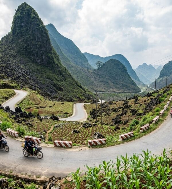
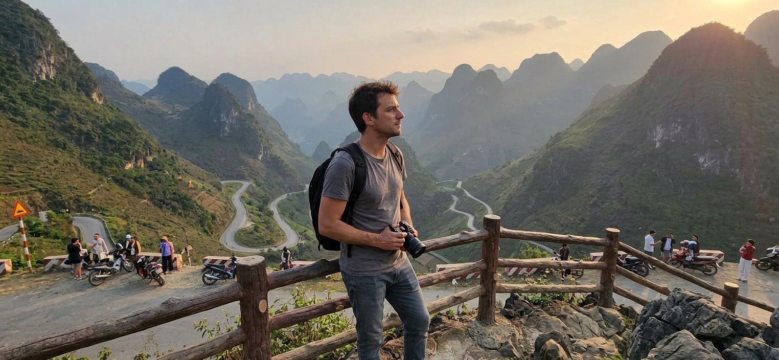
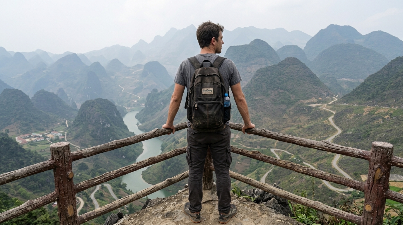
Ma Pi Leng is the centerpiece of the Ha Giang Loop. Not the most technically difficult road — that’s probably the stretch to Lung Cu — but the one that justifies everything. The 20km between Dong Van and Meo Vac along the edge of the Dong Van Karst Plateau Geopark is the reason people fly to Hanoi, take a 7-hour overnight bus, and spend four days on mountain roads in northern Vietnam.
Here’s what I wish someone had told me before I got there.
What Is Ma Pi Leng, Exactly
Ma Pi Leng (Mã Pí Lèng in Vietnamese, derived from H’mong meaning “nose of a horse”) is a mountain pass on Provincial Road 217, connecting Dong Van and Meo Vac districts in what was Ha Giang Province and is now Tuyen Quang Province following the 2026 provincial merger.
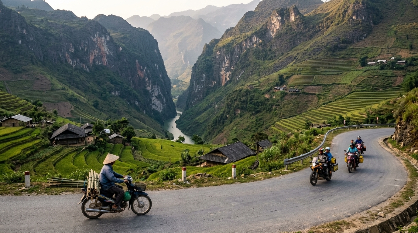
The pass sits at approximately 1,500m elevation. Below it, the Nho Que River has carved a canyon over millions of years — the same geological process that formed the Dong Van Karst Plateau Geopark, a UNESCO Global Geopark since 2010. The turquoise color of the river at the base of the canyon is a function of mineral content and depth; it looks like someone photoshopped it, but it’s real.
The road itself was built between 1959 and 1965 by roughly 1,300 young volunteers from ethnic minority communities, using hand tools. No machinery reached this terrain. The project was called Đường Hạnh Phúc — Road of Happiness — because it connected previously isolated minority communities to the provincial capital. They carved it into near-vertical limestone cliff faces over six years. The section at Ma Pi Leng required workers to be suspended in wicker baskets from ropes while drilling into the rock face. Eleven workers died during construction.
That context matters when you’re riding or driving it. This road was built by hand by people who had nothing, for communities that had even less. It being dramatic is incidental.
The Best Viewpoints — Specifically
There are three pullouts on the pass that everyone stops at. Here’s the honest ranking:
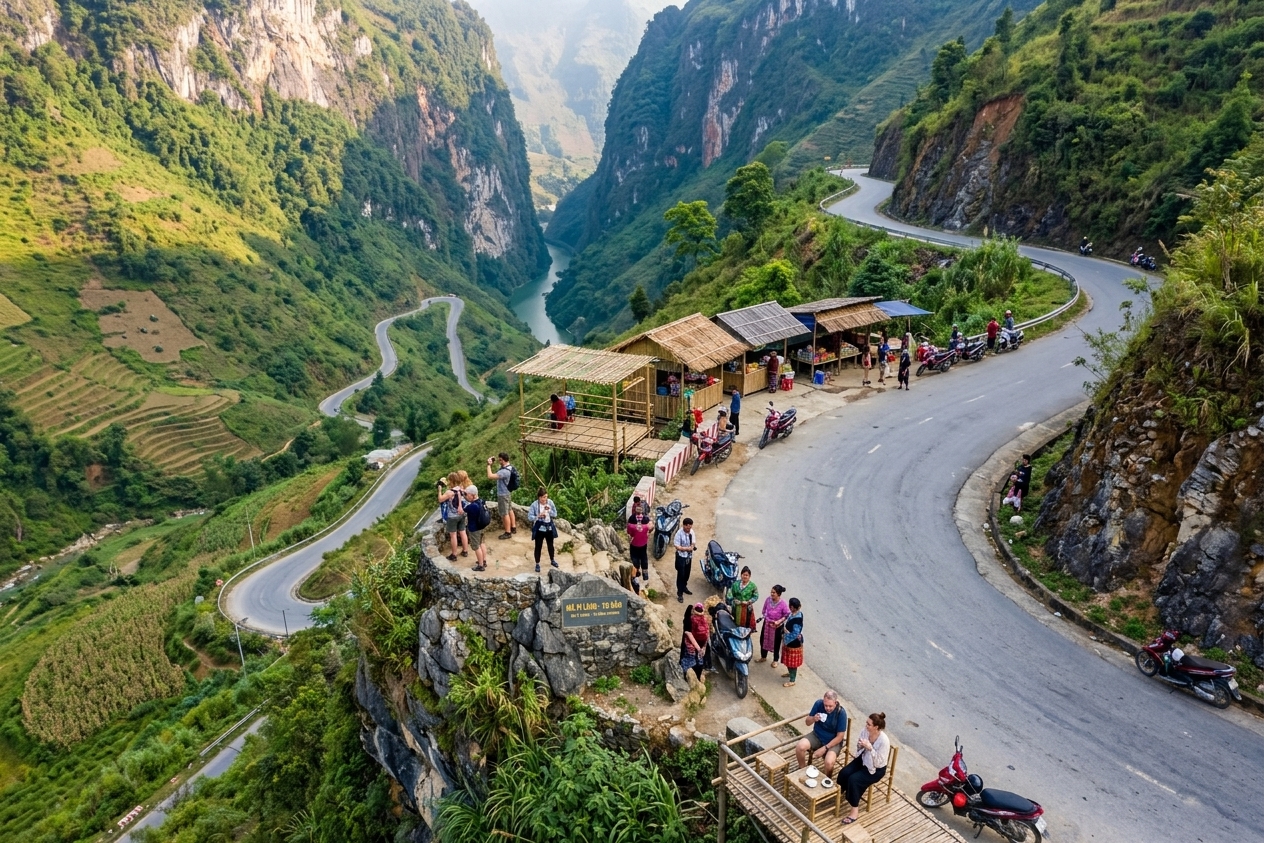
The Canyon Viewpoint (the real one)
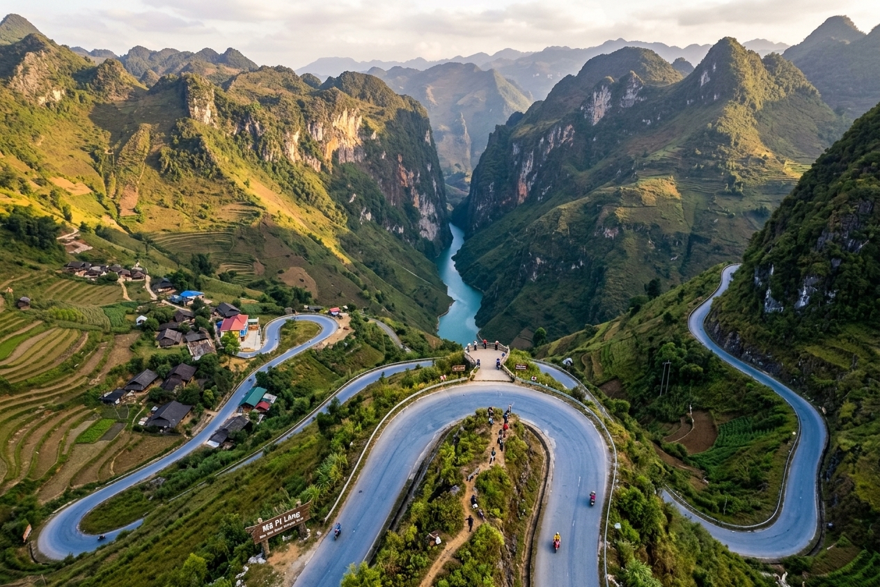
Coordinates: 23.2196° N, 105.3558° E
This is roughly the midpoint of the pass, above the deepest section of the canyon. The “main” tourist stop is marked by a small parking area and tea stalls. Walk 200m further toward Meo Vac to a flat rock ledge on the left — no signage, no stalls, no other tourists in most seasons. The drop is identical to the main stop and you’re not sharing it with tour buses. Morning fog often still sits in the canyon at 9–10am; the green appears as the fog burns off.
The Engineering Marker
Coordinates: 23.2214° N, 105.3489° E
A stone marker commemorating the Đường Hạnh Phúc construction, on a wider section of road with a partial canyon view. Worth a stop to read the inscription even if the view is secondary. Better understood after you’ve already seen the canyon — you look at the cliffs differently once you know someone hung in a basket there.
The Meo Vac Descent View
As the road descends toward Meo Vac, there’s a series of switchbacks where you can see the road you just came from etched into the cliff above. Pull over at any of the wider shoulders here — there’s no marked viewpoint, but any of them work. This is the photo you’ve seen of the road itself rather than the canyon below it.
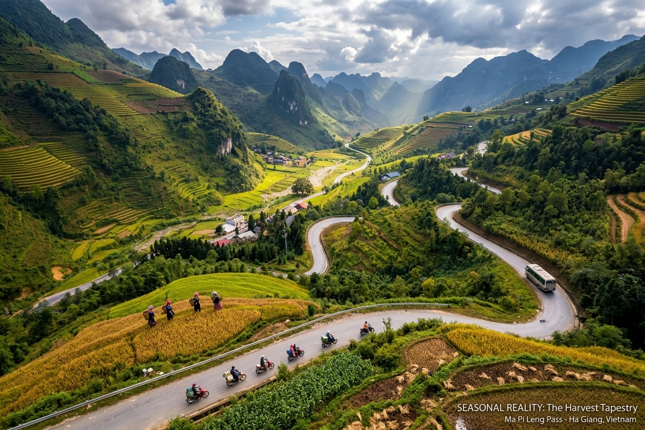
When to Go — Seasonal Reality
Fog is the main variable. When it’s in, you get a road through white nothing. When it’s out, you get one of the best views in Southeast Asia. There’s no predicting it precisely — the pass creates its own microclimate. What I’ve learned: fog usually burns off by 10–11am from March through October. If you’re coming from Dong Van, leave by 7:30am and you’re at the pass before the tour buses and after the worst fog. Coming from Meo Vac, 8am departure puts you at the pass approaching from the correct direction for morning light on the canyon.
How Long to Actually Spend Here
Most tour itineraries allocate 30–45 minutes at Ma Pi Leng. This is enough for the viewpoints and not enough for anything else. If you’re self-driving and this is your primary reason for the loop, budget 2–3 hours for the pass section itself, plus additional time if you’re doing the Nho Que River boat trip (see below).
The road is narrow. Passing trucks and buses in opposite directions requires patience — pull completely over, wait, let them come through. Don’t be the person who tries to negotiate a squeeze on a blind corner above a 700m drop. The road has been here for 60 years; it’s not going anywhere.
Nho Que River Boat Trip — Add-On Worth Doing
At the base of the Ma Pi Leng canyon, the Nho Que River runs turquoise through the karst. You can see it from the pass; you can also get in a boat on it.
The main boat dock is at 23.1756° N, 105.3801° E, accessible via a side road descending from the main pass road — look for the turn about 5km east of the main Ma Pi Leng viewpoint. The descent takes 15–20 minutes by motorbike; the boat trip itself is 30–45 minutes round-trip into the narrowest section of the gorge where the walls close in and the water goes from green to almost black in shadow.
Boat cost: 50,000–80,000 VND (~$2–3) per person. The boats fit 6–10 people; operators run continuously when there are passengers. No advance booking needed outside of peak season (October–November).
One note: the road down to the dock is steep and loose in sections. Go slow. I saw two riders put their bikes down on this descent — both were fine, but it’s not where you want to discover your brakes are soft. More detail on the river experience in the Nho Que River guide.
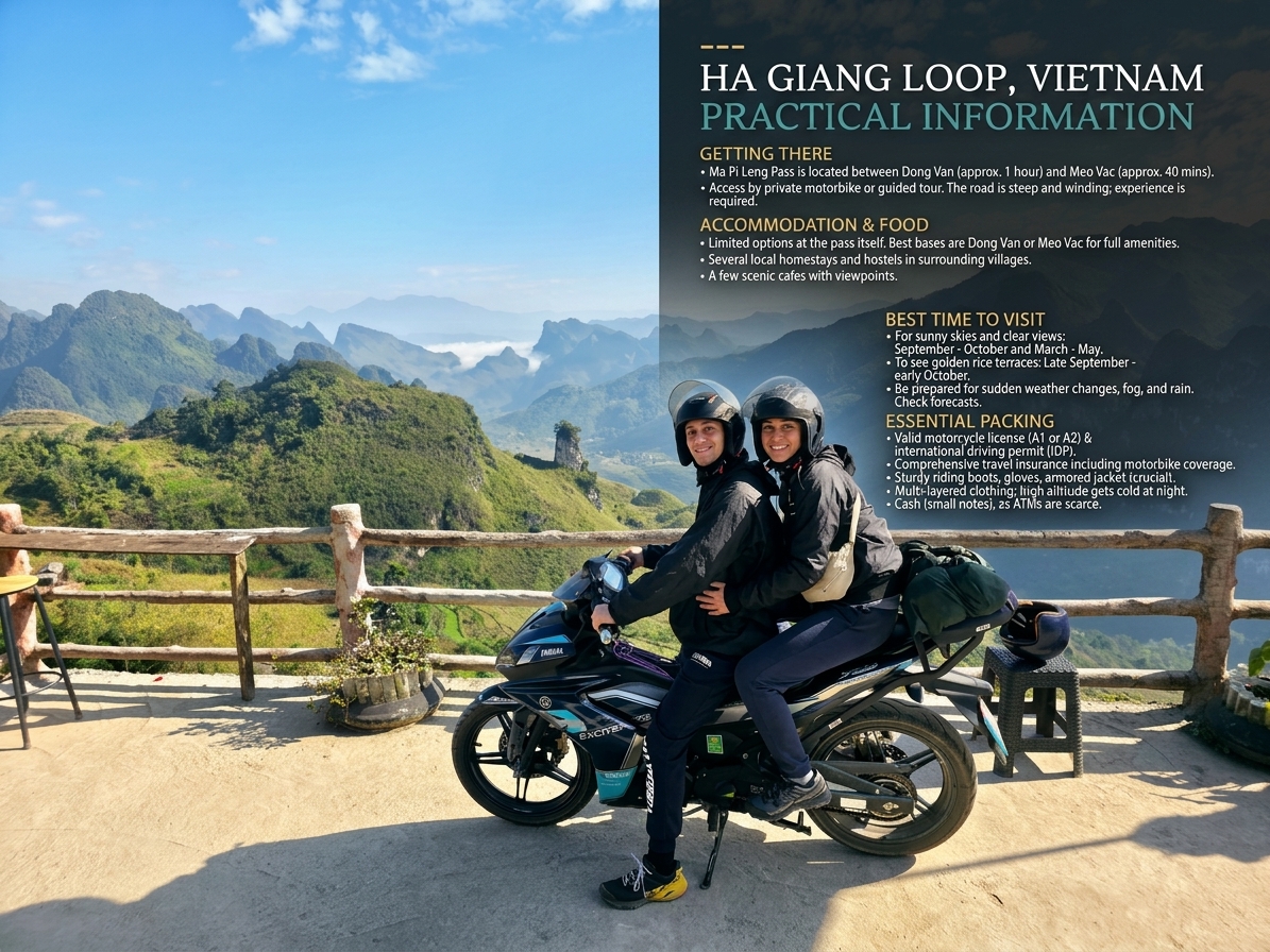
Practical Information
Getting There
Ma Pi Leng is on the Ha Giang Loop between Dong Van and Meo Vac — you pass through it as part of the loop, not as a separate excursion. If you’re coming specifically for the pass, the standard approach is:
- Overnight bus from Hanoi to Ha Giang (300,000–550,000 VND/~$11–21, 6–7 hours)
- Motorbike or jeep from Ha Giang city to Dong Van (Day 1–2 of standard loop)
- Dong Van → Ma Pi Leng → Meo Vac on Day 2 or 3
Road Conditions
The pass road is paved and in reasonable condition as of 2026. The section immediately before the canyon viewpoint (coming from Dong Van) has some patches and narrowing — not dangerous at sane speeds, but it will surprise you if you’re moving fast. The descent to Meo Vac has more switchbacks than the Dong Van approach; take them one at a time.
Fuel
Fill up in Dong Van before the pass. The next reliable fuel stop is Meo Vac town. There are occasional roadside fuel sellers (plastic bottles of petrol) on the route if you run low, but they charge a premium and supplies are inconsistent.
Altitude and Temperature
At 1,500m, the pass is meaningfully cooler than Ha Giang city — 5–8°C colder in winter, noticeably fresh in summer. Bring a jacket regardless of what the forecast says at lower elevation. Wind on the exposed sections can cut right through a light layer. For the full loop context, distances, and overnight planning, see the Ha Giang Loop guide.
What People Get Wrong About Ma Pi Leng
The main thing I see in trip reports: people expect a dramatic road and are surprised by how hard it is to process. The Nho Que canyon from the viewpoint is so deep and the color is so wrong for a mountain river that there’s a few seconds of cognitive delay where your brain is deciding whether what you’re seeing is real. That’s not hyperbole — I’ve watched a dozen people step out of jeeps and stand completely still for 15–30 seconds, saying nothing.
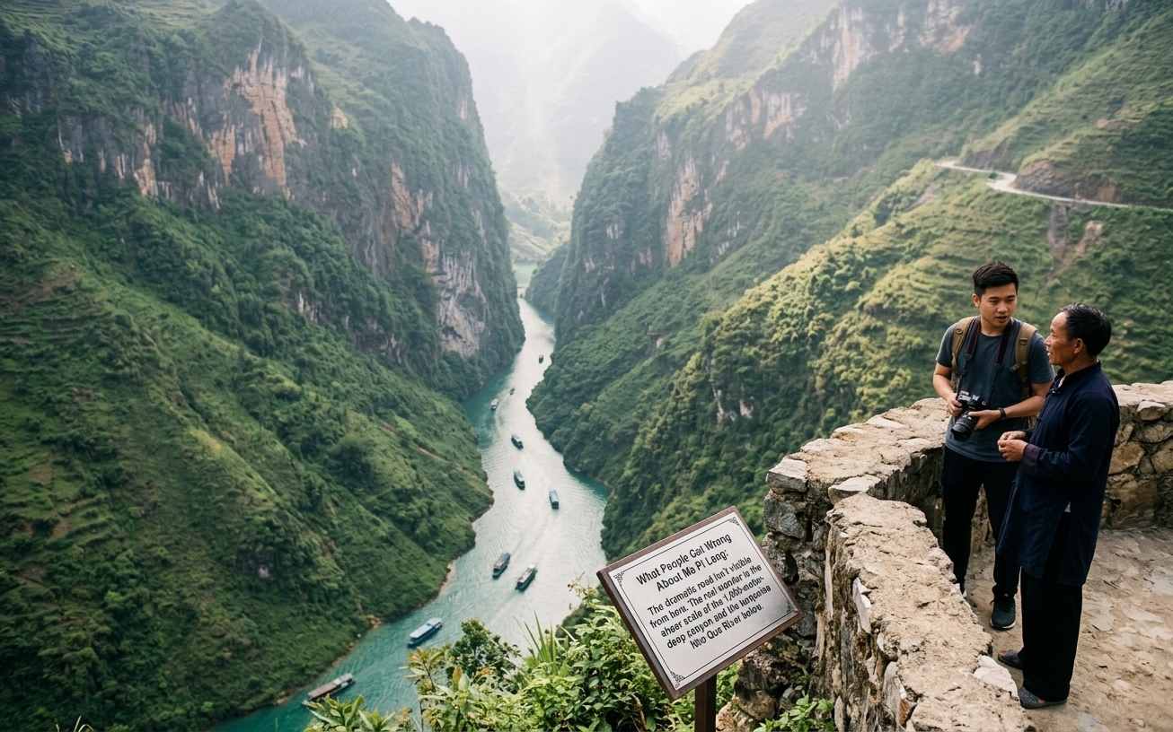
The second thing: people spend all their time at the main tourist pullout and don’t walk the extra 200 meters. The unmarked ledge further toward Meo Vac is the same view minus the tea stalls and tour bus crowds. It takes 3 minutes to walk there. Do it.
Third: the road down to the Nho Que boat dock is not signposted clearly. If you want to do the boat trip, look for the junction about 5km east of the main canyon viewpoint — a small road breaks right (east) and descends steeply. There’s usually a handpainted sign but it’s not prominent. If you pass the main viewpoint and the road starts clearly descending toward Meo Vac, you’ve gone too far — turn around.
What Travelers Actually Say: The Consensus
The consistent theme from riders who’ve done the loop: Ma Pi Leng is the section that makes the trip worth it. Not the markets, not the accommodation, not even the overall scenery — just that 400-meter stretch above the canyon. People who arrived in fog and got nothing are philosophical about it (“the road itself is still dramatic”). People who arrived in clear conditions talk about it for years.
The 200-meter walk tip is the most-cited practical piece of advice from repeat visitors. Every traveler who went past the main tourist pullout reports having the view essentially to themselves. This is the single highest return on 3 minutes of effort available anywhere on the loop.
Jeep versus motorbike is a frequent debate. Jeep travelers say they felt safer and could focus on the scenery. Motorbike riders say the experience is incomparably better — you feel the road, the wind chill at elevation, the physical reality of where you are. The honest answer: if you’ve never ridden a motorbike, the jeep is still a legitimate way to see the pass. If you ride: self-drive, not a semi-auto with a guide — the slow pace of guided groups on narrow sections is its own kind of stressful.
Real Talk
November is the most popular month and the most disappointing if you arrive mid-week. The main viewpoint has queues for photos on weekends. The 200m walk beyond the tourist pullout still works — but even that gets crowds on November Saturday mornings. Arrive by 8am or choose a different month.
Two things worth sorting before you land: a Vietnam eSIM so you have data the moment you clear customs, and travel insurance — medical costs for uninsured foreigners in Vietnam are significant.
Airalo eSIMs activate instantly. Buy before departure — airport SIM queues in Vietnam can take 30+ minutes.
FAQ
Is Ma Pi Leng pass dangerous?
Quick Answer
It’s a mountain road with narrow sections and no guardrails in places — but manageable at sensible speed. More accidents happen on the descent to Meo Vac (steeper switchbacks) than on the pass proper. Wet roads multiply the risk significantly; slow down by 50% if it’s raining.
Can I do Ma Pi Leng as a day trip from Ha Giang city?
Technically yes — it’s about 150km round-trip. But you’d be rushing it. The standard approach is to overnight in Dong Van (Day 1–2 of the loop) and ride the pass on your way to Meo Vac the next morning. Trying to do the full pass and canyon in a single day from Ha Giang means arriving in poor light and leaving in a hurry. The 3-day Ha Giang Loop itinerary maps out exactly which sections to tackle each day and where to sleep.
What’s the best direction to ride Ma Pi Leng?
Dong Van → Meo Vac (clockwise loop) puts the canyon on your left, which means you’re on the cliff-edge side. Better sightlines for the driver, and the standard direction for most tour itineraries. The reverse direction works fine too — some riders prefer Meo Vac → Dong Van to have the road behind them during the steepest descent sections.
Is the Nho Que River boat trip worth it?
Quick Answer
Yes — if you have 2 extra hours. You see the canyon from below instead of above, and the turquoise water is even more intense at river level. The road down to the dock is the sketchiest section of the day (steep, loose), but the visual payoff is real. Cost: 50,000–80,000 VND (~$2–3).
Are there entrance fees at Ma Pi Leng?
Quick Answer
The pass road itself is free. The Dong Van Old Quarter has an entrance fee of 50,000 VND (~$2). The boat trip is priced separately at the dock (50,000–80,000 VND/~$2–3). Some jeep tours include all fees in the package price — confirm before booking.
What happened to Ha Giang province? Is it still Ha Giang?
In 2026, Ha Giang Province merged administratively with Tuyen Quang Province. The region including Ma Pi Leng and the Dong Van Geopark is now part of Tuyen Quang Province. For travelers, nothing changes practically — the roads, attractions, and entry points are identical.