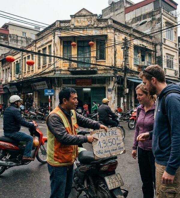
Last updated: May 2026 — prices and logistics verified May 2026.
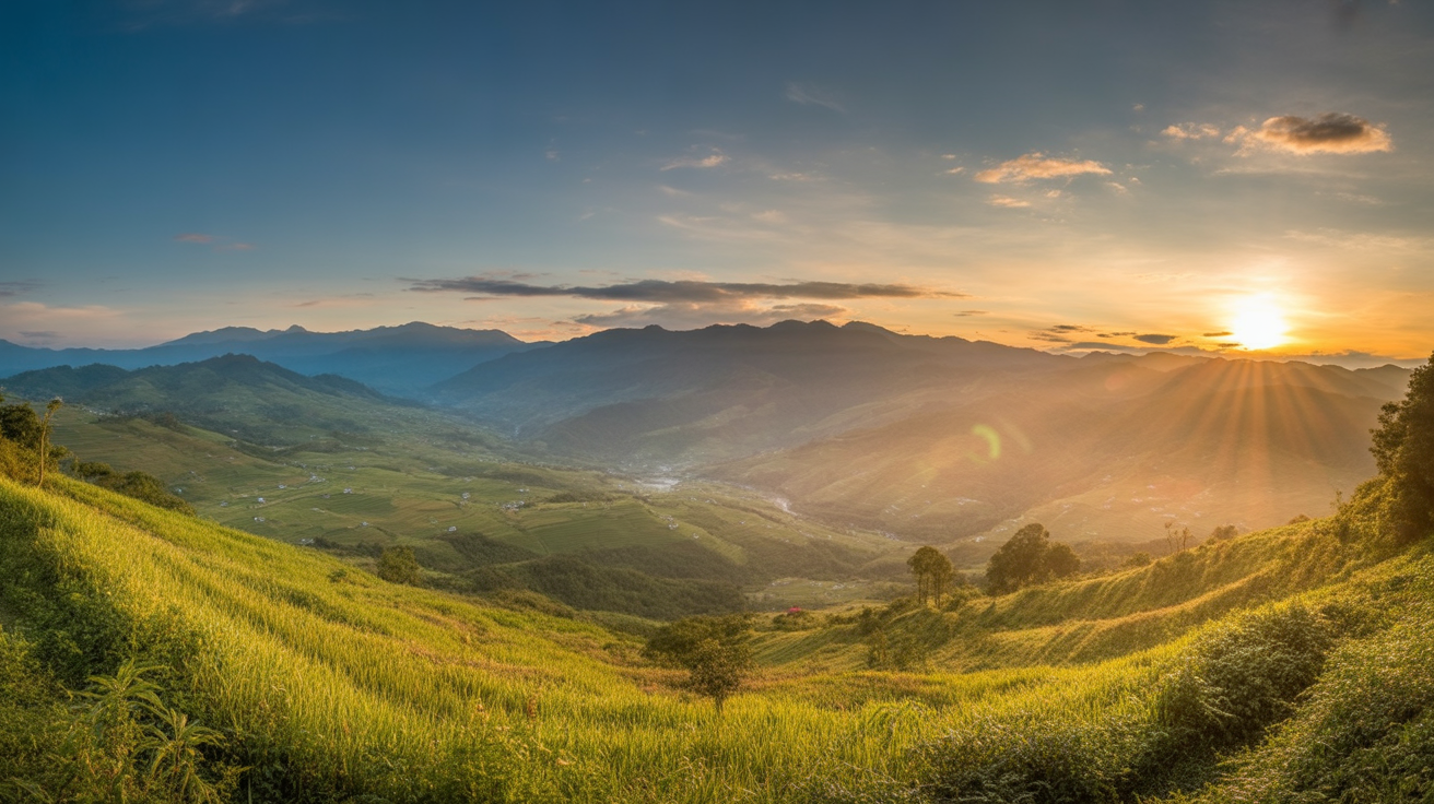
The terraces in August are not gold. They are green, dense, and beautiful in their own way — but they are not the landscape from the photographs. The photographs are from September and October, when the rice is ripening before harvest and the paddies turn from green to amber to gold over the course of three weeks. I had not known this. I had spent eight hours on a bus and five days in Sapa without taking a single photo that looked like what had brought me there.
That mistake is entirely preventable. This guide explains what the Sapa rice terraces are, when they look how, where to see them from the best angles, and how to photograph them if that’s what you came for.
What the Terraces Actually Are — and Why They Look the Way They Do
The rice terraces that define Sapa’s landscape are not a natural formation. They were hand-carved into the Hoang Lien Son (say: hwang lien son) mountains by H’mong and Tày farming communities over hundreds of years — each terrace a narrow level platform cut into the hillside to hold standing water for wet rice cultivation. The work is intergenerational: a terrace carved by a great-grandmother is still planted by her descendants today.
The engineering is genuinely remarkable. Water enters each terrace from above through a gravity-fed channel system — usually bamboo pipes or cut stone channels — and drains into the terrace below. A water management failure in one terrace ripples through the entire vertical chain. The H’mong communities who built and maintain this system understand its operation intuitively; outsiders passing through rarely see beyond the aesthetic surface.
The terraces grow one crop of rice per year in most Sapa valleys (some lower, warmer valleys grow two). The agricultural calendar drives the visual calendar:
- March–April: Fields are flooded and planted. Standing water reflects the sky; new rice is 10–20cm high, electric green. The most geometrically striking phase — water mirrors everywhere
- May–July: Rice grows tall, the terraces fill with dense green. During June–August monsoon, cloud cover is heavy and views are frequently obscured
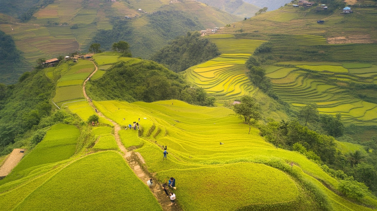
- August–September: Transition — some paddies still green, some beginning to ripen, color gradient across the hillside. September becomes gold progressively, lower terraces first
- September–October: Peak harvest season — full gold. The paddies ripen to amber-gold, then get cut by hand, leaving geometric patterns of cut stalks against dark soil
- November–February: Post-harvest. Fields grey-brown and stripped, terraces visible as architecture rather than landscape. Dramatic in a different way — the carved landform exposed
ℹKnow Before You Go
The harvest doesn’t happen uniformly across the whole valley at once. Lower elevation terraces ripen first; upper paddies stay green longer. This creates a color gradient — gold at the valley floor, green at the ridgeline — that is more visually interesting than all-gold or all-green would be. The transition weeks in mid-September and mid-October capture this gradient best.
The Best Season — An Honest Calendar
The question “what’s the best time to visit Sapa” gets answered differently depending on what you’re coming for. For rice terrace viewing specifically, the ranking is clear:
October (peak): The entire valley is in various stages of harvest — gold, amber, and cut geometric patterns of pale stubble. The weather is typically clear in the mornings with afternoon cloud. This is the most photographed month in Sapa and the most visited. Accommodation books out 3–4 weeks ahead. Bring your best patience for the trail crowds.
September (excellent): The transition into gold begins. The lower valley terraces turn first while upper paddies remain green — the color gradient at this stage is more nuanced than full October gold. Slightly fewer tourists than October, similar terrace quality in the lower valley.
March–April (excellent for different reasons): The planting season produces a landscape that looks nothing like the harvest photos — but is equally worth seeing. Flooded terraces reflecting blue sky. Rows of new rice in standing water. The geometry is sharpest during planting because the water level reveals the terrace structure without vegetation obscuring it. April coincides with peach blossom season on some ridges above the valley.
November–December (underrated): Post-harvest terraces are grey and stripped, which sounds unappealing but reveals the architectural structure of the landscape in a way that the green and gold seasons don’t. Clear weather. Cold. Almost no tourists relative to October. The Fansipan summit has its best chance of clear views.
May–August (difficult): The rice grows dense and green throughout this period, which has its own beauty — but June to August brings monsoon rains and persistent cloud that reduces valley visibility. The terraces are there; the views are not reliably available. If August is your only option, plan to work with what you get rather than expecting the iconic landscape.
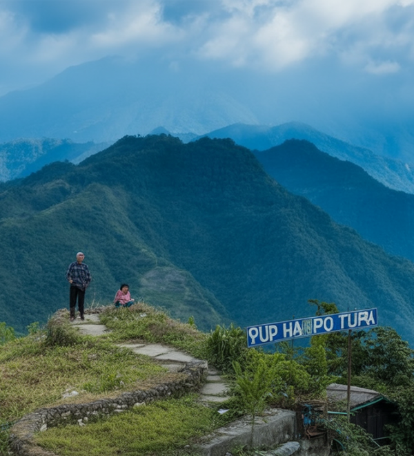
The Best Viewpoints — Where to Actually Stand
The standard tourist circuit puts you on the valley road looking across at the terraces, which produces decent photos and a sense of scale but not the immersive experience. The best viewpoints require getting off the road — either higher or lower.
Above Ta Van — the road viewpoints: The road from Sapa to Ta Van climbs and descends through several pronounced curves. At three or four of these curves, the hillside opens and the full Muong Hoa Valley is visible — a sweep of terraces from the ridge down to the river. These are not marked viewpoints; they’re just places where the road bends and the valley appears. Ask a xe ôm driver to slow down at the “điểm nhìn đẹp nhất” (say: diem nyin dep nyat — most beautiful view) on the Ta Van road. Most know exactly where to stop.
On the footpaths, looking up: The view from inside the valley looking up at the terraces above you is fundamentally different from the road view. You’re surrounded by the terraces rather than observing them from outside. This is the perspective you only get on the trekking route — you can’t see it from a vehicle.
The upper terraces above the Sapa town road: Few visitors walk 10–15 minutes above Sapa town along the ridge path above Ham Rong Mountain. The terraces here are smaller and less dramatic than Muong Hoa, but they’re a 15-minute walk from the town center, completely empty of tourists in early morning, and the light across them at 7am in October is genuinely excellent.
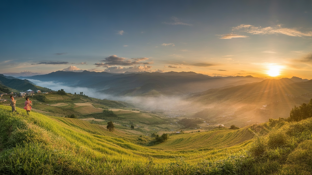
O Quy Ho Pass viewpoint: The mountain road toward O Quy Ho Pass (say: oh kwee ho) — 12km from Sapa — has a pullout above the terrace zone where the Muong Hoa Valley and surrounding hillsides are visible simultaneously. This is the elevated perspective that makes the full scale of the terrace system comprehensible. Best at late afternoon (4–5pm) when the light comes from the west.
↗Insider Tip
The most popular photo viewpoint in Sapa — the one used in most travel publications — is taken from a specific curve in the road about 4km above Ta Van, looking northeast across the valley. Google “Sapa rice terrace drone view Muong Hoa” and you’ll see the angle. From the road, with a wide lens, this is achievable without drone equipment. The GPS coordinates for the approximate spot: 22.3095° N, 103.8510° E — park the motorbike at the curve and walk back 50 metres toward the valley edge.
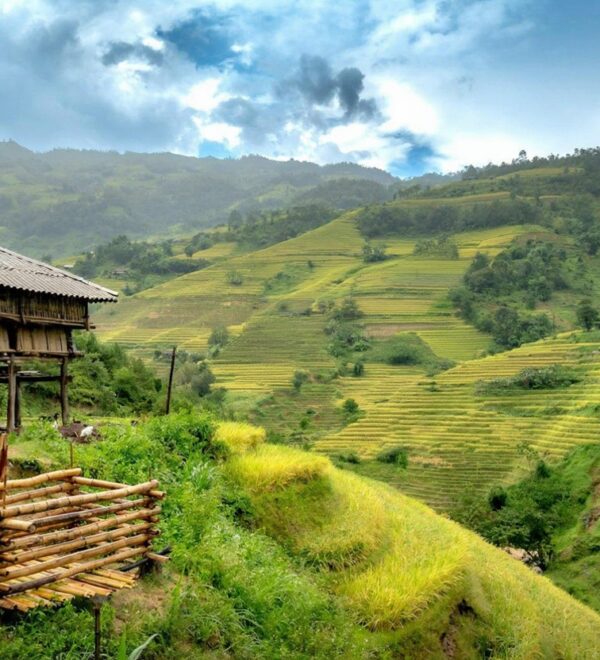
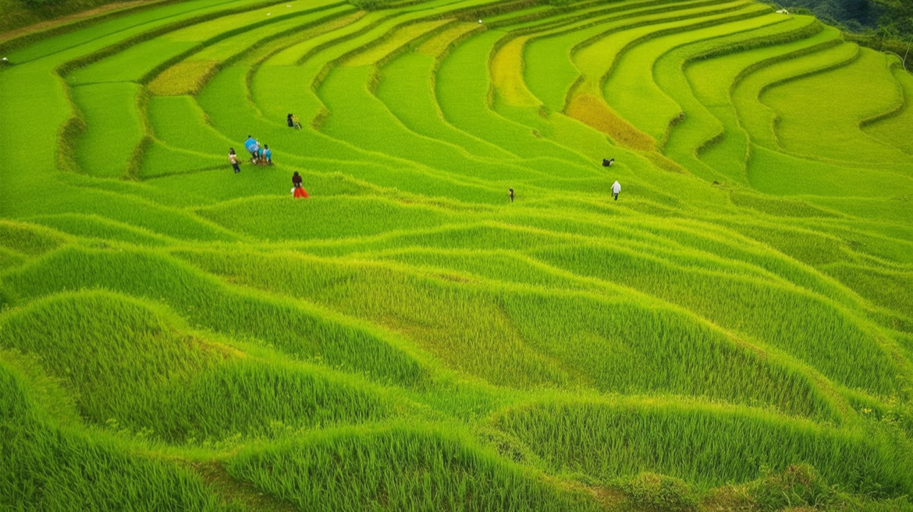
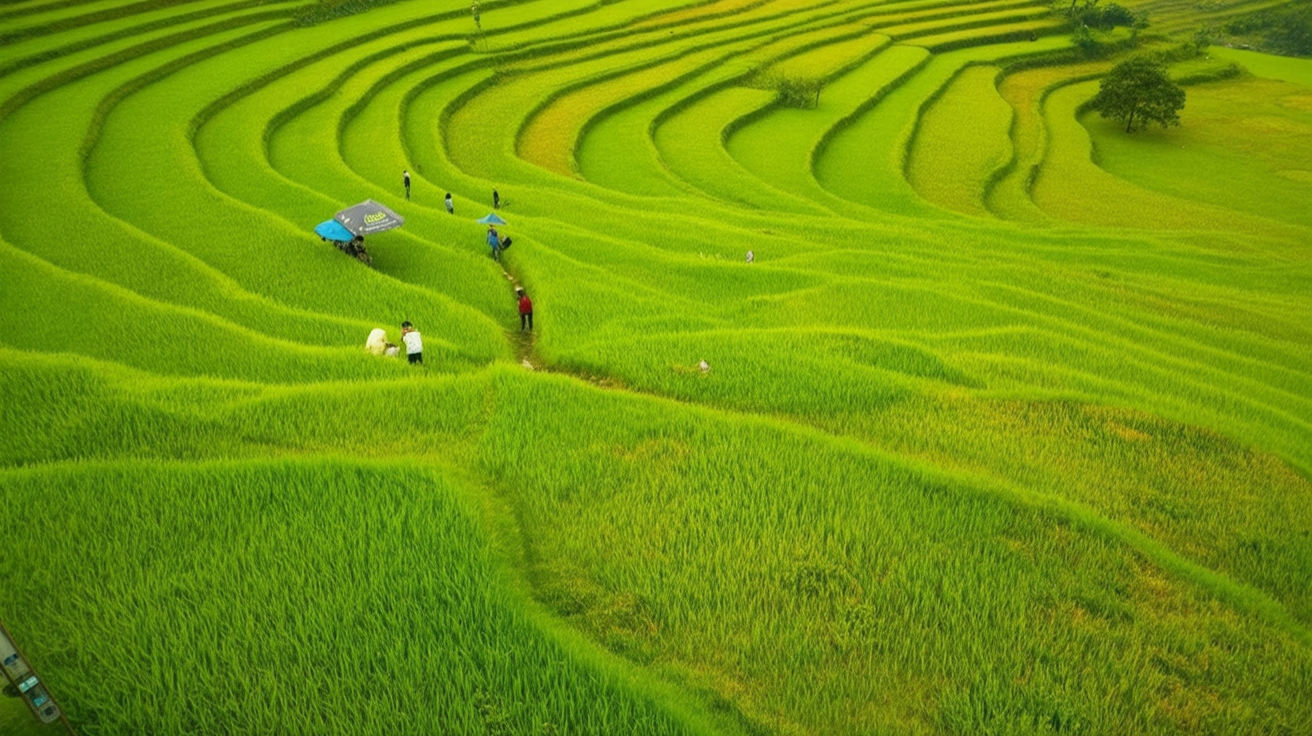
Muong Hoa Valley — The Signature Terrace Landscape
The Muong Hoa Valley produces the images that define Sapa’s identity: narrow terraces cascading down a steep hillside, the valley floor 400 metres below the ridge, rice at various stages of cultivation creating a mosaic of green and gold. The scale is best understood from above; the texture is only understood from inside.
The valley runs 15km southeast from Sapa town, dropping from 1,600m at the town to approximately 900m at the valley floor near Ta Van village. The terrace system covers most of the hillside on both sides of the valley — east and west faces, different light at different times of day.
East-facing terraces catch morning light (7–10am). West-facing terraces catch evening light (3–6pm). For photography: the east face of Muong Hoa catches the best morning light; the west face catches late afternoon. If you’re in the valley at midday, you’re in the worst light regardless of the season. This is not negotiable.
The terraces visible from the road are the famous ones — large, well-maintained, and frequently photographed. The terraces reached by walking footpaths above and below the road are smaller, more irregular, and show the agricultural reality of the system more clearly. Both are worth seeing; the footpath terraces reward a slower pace.
Beyond Muong Hoa — Other Terrace Areas Worth Finding
The Muong Hoa Valley dominates Sapa’s terrace reputation. These alternatives see a fraction of the visitor numbers:
Y Linh Ho Village (say: ee lin ho): A small village 3km below Ta Van on the river trail, with terraces cut into a narrower, steeper valley section. The scale here is more intimate — individual terrace walls visible from the path, the geometry tighter. Almost no tourists make it this far. In October, the combination of cut terraces and uncut ones produces a patchwork that photographs differently from the standard Muong Hoa wide shots.
Séo Mý Tỷ (say: say my tee): A village 15km from Sapa on unpaved road requiring motorbike access. The terrace system here is carved into steeper terrain and has a different visual character — narrower terraces, sharper ridgelines, more evident engineering. The village is rarely visited and accommodation consists of a handful of basic homestays. Worth the road if you have a second day to spare and want terrace landscape without the Muong Hoa crowd. Where you sleep is the single biggest decision in a Sapa trip — our Sapa accommodation guide breaks down the Ta Van village homestays versus Sapa town hotels, with specific places and honest prices.
Tả Van Giáy area: The Giáy (say: zay) ethnic minority community in the lower Muong Hoa Valley near the river — distinct from the H’mong communities higher up — cultivates terraces with slightly different water management techniques. Visible from the footpath between Ta Van and Lao Chai, and worth noting for the architectural differences in the terrace walls.
Photography Guide — Making the Most of the Landscape
The Sapa rice terraces are one of the most photographed landscapes in Southeast Asia. Getting a photograph that looks different from the ten thousand already online requires timing, positioning, and some understanding of what makes the landscape work visually.
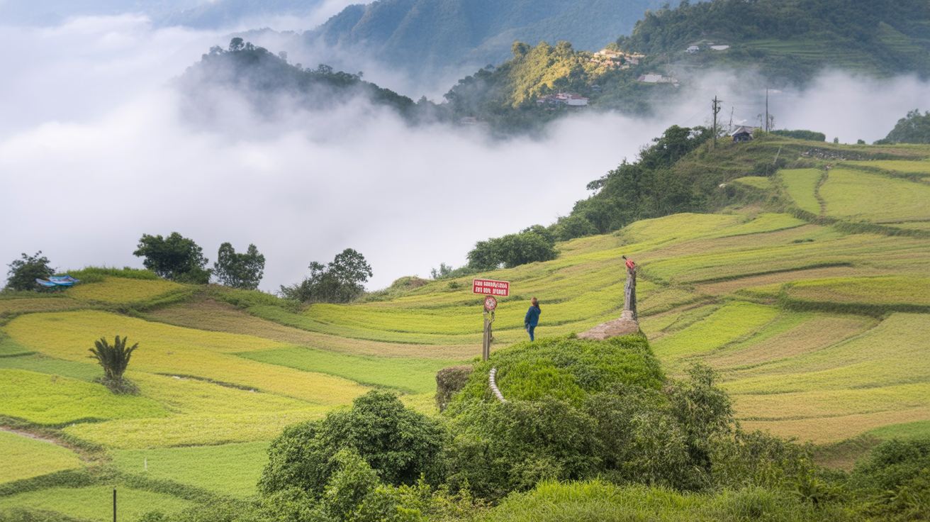
Timing: 6–8am. The valley holds mist at dawn — a layer of cloud sitting below the ridge line while the terrace tops are clear. As the sun rises, this mist begins to lift and burn off. For roughly 90 minutes, the terraces above the mist line are lit by horizontal golden-hour light while the valley below remains obscured. This is the photograph. By 9:30–10am, the mist is gone, the light is harsh and flat, and the landscape looks like any other field.
Lens choice: Wide-angle (16–35mm equivalent) for the scale of the full valley. Standard (35–50mm) for the texture of individual terraces. Telephoto (85–200mm) for compression shots that make the terrace tiers appear stacked and dense. All three produce different images from the same location.
Foreground: The terrace photographs that work best have a physical element close to the camera — a path, a wall, a person, a tree — that anchors the depth. Wide shots of just terraces without foreground interest tend to lose the sense of scale. A farmer carrying a load up the ridge path in the near distance, or a row of terrace walls close enough to show the hand-cut stone, gives the image weight.
Weather: Overcast light eliminates harsh shadows and brings out the green saturation in planting season. Direct sun in harvest season produces the gold color at its most vivid. Both work; neither is wrong. Fog is the wild card — a valley half-obscured by morning mist with terraces emerging from it is more interesting than a fully clear day in most cases.
ℹKnow Before You Go
Drone photography requires a permit from Vietnam’s Civil Aviation Authority (Cục Hàng không Dân dụng Việt Nam) — a process that takes days and is rarely practical for short visits. Drone flights without permits are illegal and the fine is meaningful. The ground-level photographs available from the ridge viewpoints and footpath sections are excellent and don’t require a permit. If you see drones flying in Sapa without evident commercial operation, they’re likely flying illegally — not a standard you should copy.
Sapa vs Mù Cang Chải — Which Terraces Are Worth the Journey?
The two most famous rice terrace destinations in northern Vietnam — Sapa and Mù Cang Chải (say: moo kang chai) — get compared constantly. The comparison is worth addressing directly because they are genuinely different landscapes, and the right choice depends on what you’re after.
Scale: Mù Cang Chải has terraces that are larger in individual plot size and more visually open — the valley is wider, the slopes less steep, and the terrace walls longer. Sapa’s Muong Hoa terraces are narrower, more vertically compressed, and feel more dramatic from inside the valley. Neither is objectively better; they’re different shapes of the same beauty.
Access: Sapa is 5–6 hours from Hanoi by overnight bus with well-developed tourist infrastructure. Mù Cang Chải is 6–7 hours from Hanoi by day bus on mountain roads — a harder journey with significantly less tourist accommodation, fewer guides, and less English spoken. For most travelers, Sapa is the practical choice. For photographers and travelers specifically seeking the terrace landscape over everything else, Mù Cang Chải is worth the added effort.
Crowds: Sapa in October is busy. The Muong Hoa Valley trail has hundreds of people on peak weekends. Mù Cang Chải in October is also busy — it has had a photography festival around harvest time for years — but the scale of the destination means the crowd is more distributed. The individual terrace photo is easier to get without a tour group in the frame. The Muong Hoa Valley trail system is harder to navigate without local knowledge than it looks — our Sapa trekking guide covers route options, how to find a guide, and the seasonal leech situation.
Verdict: If you have one chance to see northern Vietnam rice terraces, Sapa is the better all-round trip — the trekking, village homestays, and community access add context that Mù Cang Chải currently doesn’t match. If you’ve already done Sapa and want the pure landscape experience, add Mù Cang Chải to a north Vietnam itinerary as a secondary destination.
→Who It’s For
Sapa terraces: first-time visitors to northern Vietnam, travelers who want trekking + cultural immersion + landscape. Mù Cang Chải: repeat Sapa visitors, serious landscape photographers, travelers who specifically want to photograph terraces without the trail crowds.
Understanding the Communities Who Built This
The rice terraces are inseparable from the people who made them. Most visitors see the H’mong as the uniform “terrace builders” of Sapa — but the communities in and around the valley are ethnically distinct, with different languages, different agricultural traditions, and different relationships to the landscape.
Black H’mong (Hmong Đen, say: hmong den): The dominant community in the Muong Hoa Valley — Ta Van, Lao Chai, Giang Ta Chai. Recognizable by indigo-dyed clothing — a distinctive blue-black achieved through repeated dyeing in indigo vats. The Black H’mong have farmed the Muong Hoa terraces for approximately 300 years, having migrated from southern China. The terrace wall construction techniques they use are specific to their community.
Red Dao (Dao Đỏ, say: zow do): The community in Tả Phìn village, 12km north of Sapa. The Red Dao terraces sit in a different valley and use a different water management system than the H’mong terraces. Their terraces are less visited and slightly less spectacular visually — but the community’s agricultural traditions (including the famous herbal bath) reflect a different relationship with the mountain landscape than the H’mong do.
Tày (say: tay): Found in the lower sections of the Muong Hoa Valley near the river. The Tày are lowland farmers who moved up the valley and adapted wet rice techniques to the terrace environment. Their terrace sections tend to be wider and flatter than the upper H’mong terraces — visible in the lower valley between Lao Chai and Y Linh Ho.
Understanding which community farmed which section of valley is not academic information — it’s the context that makes the terrace walk more than a scenic hike. A guide from the specific community you’re walking through will tell you things about their section of the terraces that no guidebook carries.
The Terraces as a Living System — Not Just a Landscape
One thing that changes how you experience the Sapa terraces once you understand it: this is not a preserved heritage landscape. It’s an active, working agricultural system that produces food for the communities who built it.
The families tending the terraces are not performing traditional culture for tourists. They are farming. The woman bending over a paddy at 7am in a traditional H’mong dress is planting or weeding or managing the water flow into the next terrace down — practical work that happens to look beautiful from a distance and has happened on these specific hillsides for generations.
The terraces are only maintained because the farming is still economically viable. If it stops being viable — if young people leave for cities, if the economics shift, if water management is neglected — the terraces begin to erode within years. Several terrace systems in northern Vietnam that were photographed extensively in the 1990s and 2000s have partially collapsed since then as communities moved away from subsistence farming.
Staying in village homestays rather than Sapa town hotels, hiring local H’mong guides, and buying from village cooperatives are all small contributions to keeping the economics of terrace farming viable. It’s not the primary reason to do these things — they’re simply better experiences — but the connection between where your money goes and the preservation of what you came to see is real.
Frequently Asked Questions
Are the Sapa rice terraces worth visiting?
Yes, with correct timing. The landscape is genuinely extraordinary in September and October, and genuinely impressive (though different) in March–April. It is not worth the journey if you arrive in August expecting the harvest photos — you will be disappointed. If you can control your travel dates, plan around October or March. If you can’t: come anyway, adjust expectations, and find the beauty in what the terraces actually look like when you’re there rather than what the photos show.
Where are the best viewpoints for Sapa rice terraces?
The elevated road curves between Sapa town and Ta Van village (approximately 4km above Ta Van) give the widest valley views — stop at the road bends, not just the marked viewpoints. The O Quy Ho Pass road provides an elevated perspective showing multiple valleys simultaneously. The footpaths inside Muong Hoa Valley give the close-up texture view. All three perspectives together constitute a complete visual understanding of the terraces.
Can you see rice terraces without trekking?
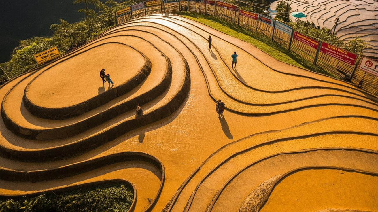
Yes. The road from Sapa to Ta Van passes through the terrace zone — a motorbike taxi or car can take you to the elevated viewpoints without any walking required. Cat Cat Village (2km from town, easy path) also sits within the terrace landscape. The full scale and texture of the terraces is only accessible on foot, but the overview is visible from the road.
Are Sapa rice terraces UNESCO World Heritage?
Not yet formally designated, though the Hoang Lien Son landscape including the Sapa terraces has been nominated and has UNESCO recognition as a biosphere reserve. Vietnam has submitted the terraces for World Heritage consideration as part of a broader nomination covering multiple northern Vietnam terrace landscapes (which also includes Mù Cang Chải and Hoàng Su Phì — both also worth visiting on a north Vietnam itinerary if you have the time).